We kindly ask for your patience as we work on rebuilding this website. Your understanding is appreciated; thank you!
snapshots in time
The history of the San Fernando Valley stretches back over 8,000 years, where it served as the home to the Tongva, Tataviam (to the north), and Chumash (to the west) Indigenous peoples. These Native American communities flourished in the Valley and its surrounding arroyos, establishing numerous settlements, trading posts, and hunting camps. However, their way of life faced upheaval with the arrival of the Spanish in 1797.
Upon the Spanish arrival, significant changes ensued. In 1797, the Spanish claimed the Valley for the establishment of the Mission San Fernando Rey de España and the sprawling Las Californias ranchos. The first Spanish land grant in the region, Rancho Encino, situated in the northern part of the San Fernando Valley, marked the beginning of this era of Spanish colonization. Granted to Juan Francisco Reyes, Rancho Encino was adjacent to a Tongva village and featured an adobe dwelling built beside a natural spring. However, the life of Rancho Encino was brief, as the land was later traded to accommodate the establishment of the Mission San Fernando Rey de España.
The Mission, founded in 1797 as the 17th of the twenty-one missions, became a focal point in the Valley's history, influencing its development and cultural landscape. The trade of land led to the establishment of Rancho Los Encinos, also located near springs, where Juan Francisco Reyes settled. This area is now recognized as the site of Los Encinos State Historic Park in Encino.
Subsequently, during the Mexican era, further land grants were issued to cover different parts of the San Fernando Valley. These grants included Rancho El Escorpión (located in present-day West Hills), Rancho Providencia, and Rancho Cahuenga (in Burbank), as well as Rancho Ex-Mission San Fernando, which encompassed the rest of the Valley. These land grants played a crucial role in shaping the landscape and land use patterns of the San Fernando Valley during this period of transition and colonization.
What follows are images that the depict development of the southwest corner of the San Fernando Valley, once known as Girard, then Woodland Hills. Where available, photos of modern Woodland Hills accompany period photos to highlight changes over the years.
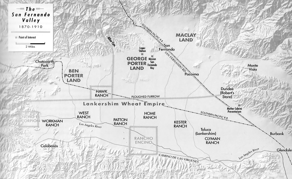
Figure 0. Early map of the San Fernando Valley showing locations of towns and ranches. (Water and Power Associates, Inc. (n.d.).
The San Fernando Valley experienced a division primarily between the expansive Lankershim ranches and the Maclay-Porter lands. These vast agricultural estates dominated much of the Valley's landscape. Following the establishment of these ranches, the Valley witnessed the emergence of several towns starting from the year 1873. Notable among these settlements were San Fernando, Burbank, and Toluca. As these towns grew, they played pivotal roles in shaping the Valley's economic and social landscape, attracting settlers, businesses, and infrastructure development.
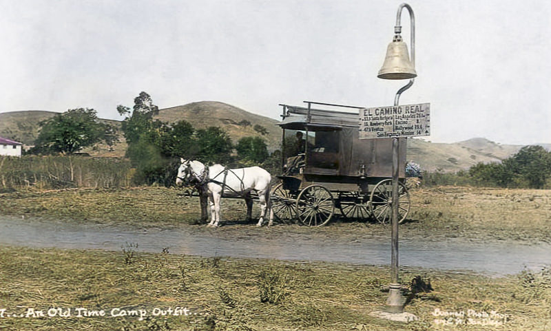
Figure 0.1 An old-time camp outfit is depicted near the intersection of Ventura Boulevard and Valley Circle Boulevard. In the background (center-left) stands the historic Leonis Adobe. (Water and Power Associates, Inc. (n.d.).
In the early 1900s, an old-time camp outfit can be observed near the junction of Ventura Boulevard and Valley Circle Boulevard. In the background (left edge of the photograph), stands the renowned Leonis Adobe, a notable adobe dwelling dating back to either the 1840s or 1860s. Belonging to prominent rancher Miguel Leonis, the Leonis Adobe provides insight into the Valley's abundant agricultural and ranching legacy. Its presence underscores the historical importance of the region as a pivotal center for ranching and settlement during the 19th century.
Additionally, the scene features a sign attached to an El Camino Real bell marker, providing distances to various destinations along the 600-mile (965-kilometer) commemorative route connecting the 21 Spanish missions in California. The El Camino Real, also known as the King's Highway, was a vital road connecting the Spanish missions in California during the colonial era.
The distances listed on the sign indicate key waypoints along this historic route, including 83.9 miles to Santa Barbara, 18 miles to Newberry Park, 47.9 miles to Ventura, 26.1 miles to Los Angeles, 8 miles to Encino, 19.6 miles to Hollywood, and 14 miles to San Fernando Mission. The placement of El Camino Real bell markers along the mission routes facilitated travel and navigation, contributing to the development and connectivity of early California communities.
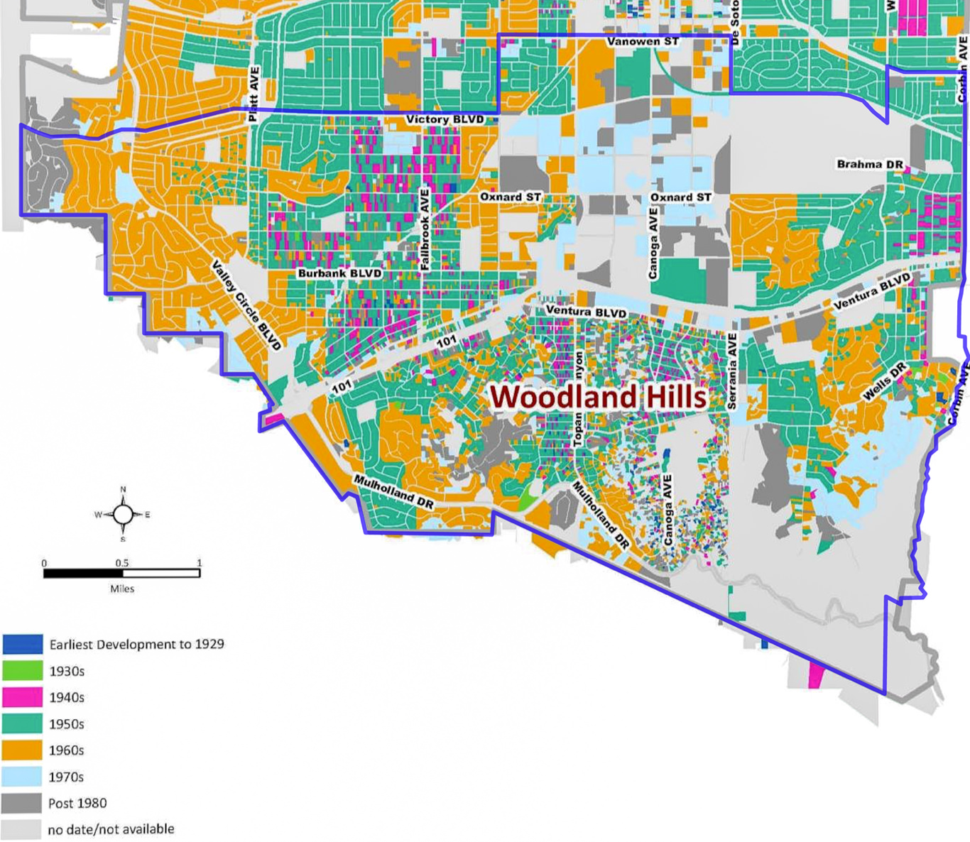
Figure 1. Map of development history of Woodland Hills (Architectural Resources Group, Inc., 2013).
While the San Fernando Valley is commonly associated with expansive post-World War II suburban growth, it's important to recognize that the southwest San Fernando Valley boasts a diverse development history spanning back over two centuries. In the mid-nineteenth century, significant portions of the far western San Fernando Valley, extending into Ventura County, formed part of the expansive Leonis Ranch, overseen by Miguel Leonis. Within this vast ranch, Leonis held control over Rancho El Escorpion (now known as West Hills) and additional acreage obtained through California homestead laws. However, following Leonis's passing in 1889, his land holdings began to diminish as portions were gradually sold off by relatives and his widow, Espiritu.
By 1950, only 100 acres remained, eventually earmarked for the residential development of Hidden Hills. Notably, remnants of the Leonis legacy endure to this day, with the historic Leonis Adobe (now a museum) standing near the intersection of Ventura Blvd. and Valley Circle. Leonis Adobe serves as a tangible link to the Valley's past, adjacent to the historic route of El Camino Real, a vital artery in California's colonial-era transportation network.
mid-1920s
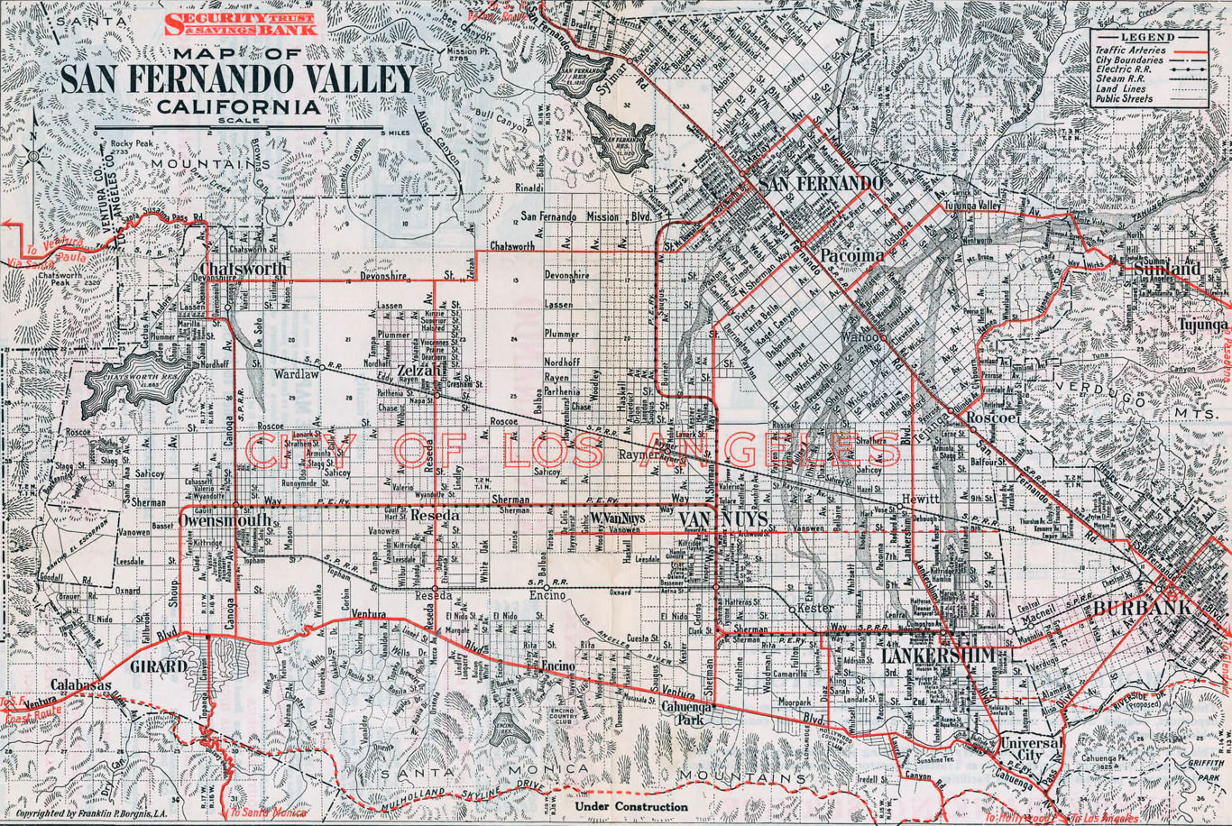
Figure 2. Detailed map of the San Fernando Valley as it appeared in the mid-1920s. Note the boundaries of Girard (lower left of photo) (Water and Power Associates, Inc., n.d.).
Note that Mulholland Skyline Drive (bottom, left to right), later renamed Mulholland Highway, is under construction. Also four community names are shown that do not appear on today’s maps (left to right): Girard, Owensmouth, Zelzah, and Lankershim.
2015
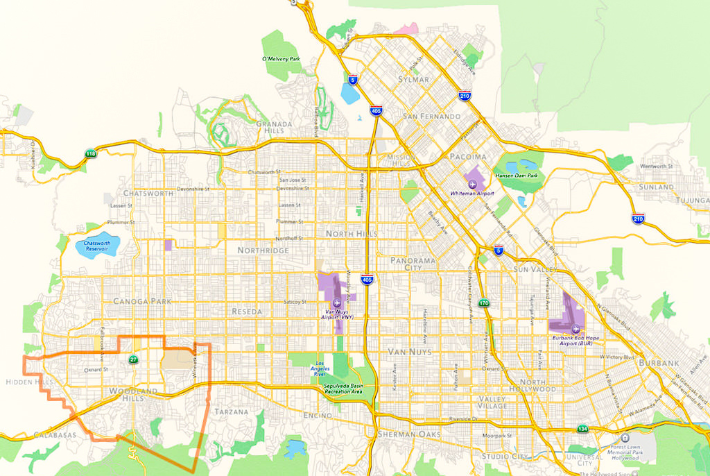
Figure 3. Map of modern San Fernando Valley with outline of Woodland Hills (Leggatt, 2015).
circa 1914
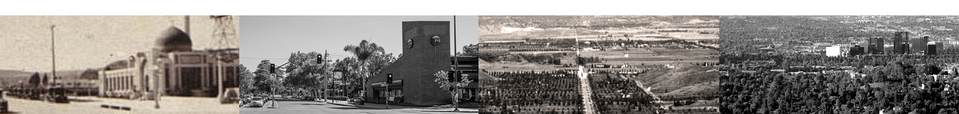
As viewed from the top of Topanga at the summit, one can see Topanga Canyon Blvd. running north-northwest (center left) through large farms and an orchard. Inside of a decade, the area will have been named Girard, as trees and homes begin to populate areas of what is now Woodland Hills.
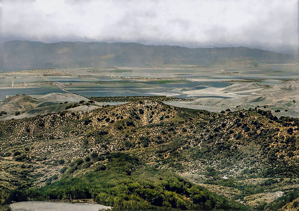
Figure 4. View looking north-northeast from Topanga Summit to San Fernando Valley, 1914 (University of Southern California, n.d.).
As viewed from the top of Topanga at the summit, one can see Topanga Canyon Blvd. running north-northwest (center left) through large farms and an orchard. Inside of a decade, the area will have been named Girard, as trees and homes begin to populate areas of what is now Woodland Hills. The expansive, level valley stretches out in the center, divided into numerous sizable farm parcels. A quaint orchard is noticeable at the heart of the scene, while Topanga Canyon Blvd. traverses the valley to the left. In the foreground, rugged, forested hills dominate the landscape, contrasting with the vastness of the valley below. Majestic mountains loom in the background, adding to the picturesque vista.
1920
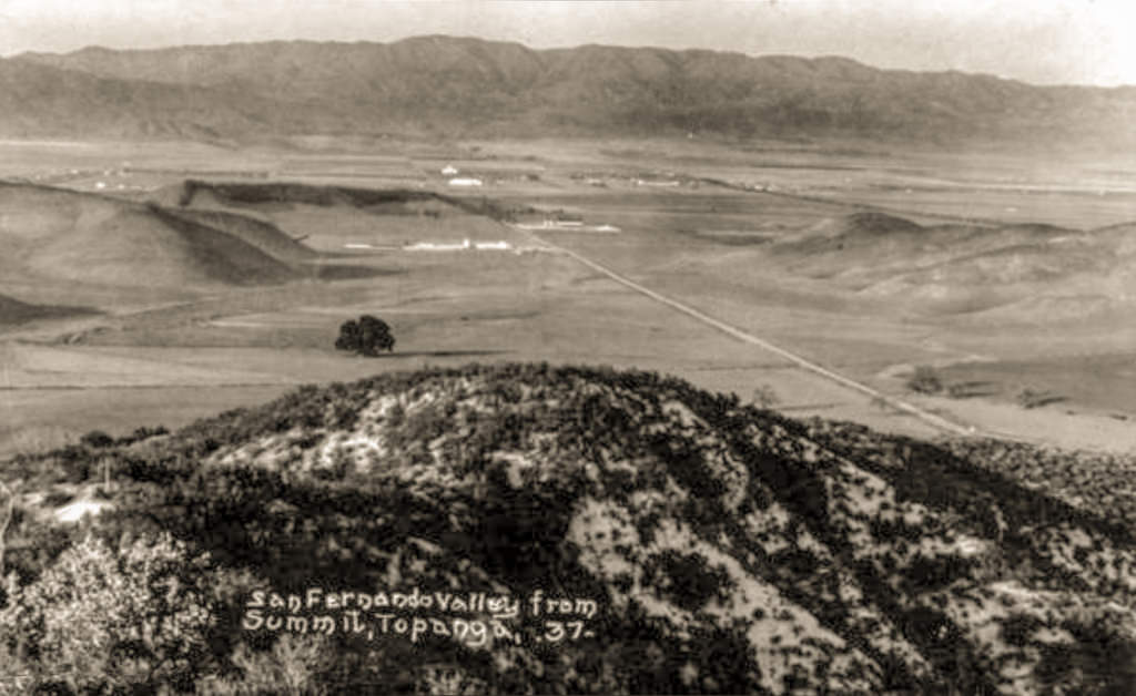
Figure 4.1. Late afternoon view looking north at Girard from Topanga Summit; Topanga Canyon Blvd. runs from lower right to upper centre, 1920 (Pierce College Equestrian Center, n.d.).
circa 1920
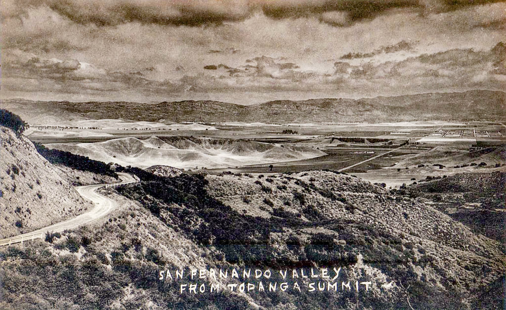
Figure 5. Top of Topanga Canyon Blvd. at summit, circa 1920 (San Fernando Valley Blogspot, n.d.).
2015
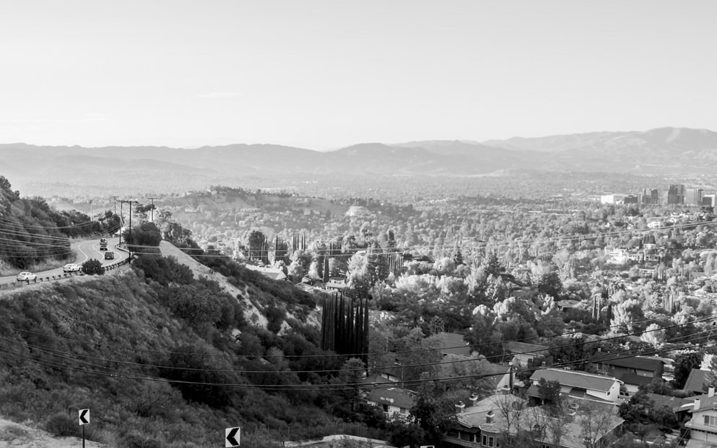
Figure 5.1 Top of Topanga Canyon Blvd. at summit (Leggatt, 2015).

Figure 5.2 Top of Topanga Canyon Blvd. at summit, circa 1920 just before the arrival of Victor Girard (San Fernando Valley Blogspot, n.d.).
1920s
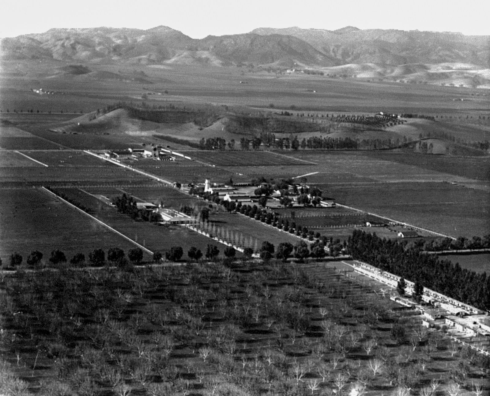
Figure 6. Looking east-southeast at Brant Ranch on Oxnard, near tree-lined Canoga Ave. running left to right (Water and Power Associates, Inc., n.d.).
In this aerial snapshot from the 1920s, we catch a glimpse of Owensmouth, situated just north of Girard, which is now known as Woodland Hills/Warner Center, looking northwest. Prominently featured at the center of the photo is Brant Ranch, a significant landmark in the area. The diagonal stretch of Oxnard Street runs from the lower-right to the upper-left corner of the image, defining the landscape's urban layout. Meanwhile, the foreground is graced by the serene presence of tree-lined Canoga Avenue, stretching horizontally from left to right.
Originally christened Owensmouth by Hobart Johnstone Whitley, the general manager of the Los Angeles Suburban Home Company, the area's name carried a touch of promotional flair. Whitley famously touted Owensmouth as the "new mouth of the Owens River," a claim made in anticipation of the imminent completion of the Los Angeles Aqueduct the following year. Founded on March 30, 1912, Owensmouth quickly gained attention as a burgeoning community, ripe with opportunities for real estate investment and development. The Suburban Home Company, spearheading this venture, enlisted the services of the Janss Investment Company to facilitate the sale of properties, further fueling the town's growth and expansion.
1922
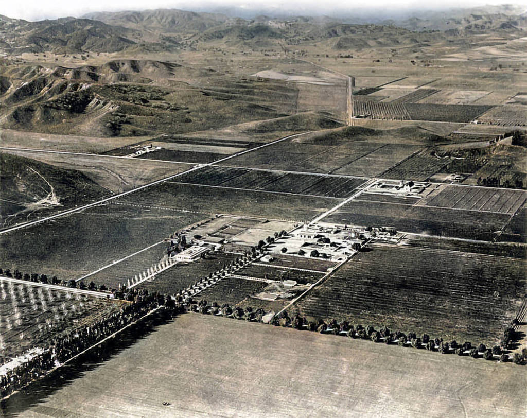
Figure 6.1. Looking southwest at Brant Ranch on Oxnard, near tree-lined Canoga Ave. Note that Girard had not yet erected his "mosques" on corner of Ventura Blvd. and Topanga Canyon Blvd. (upper center-left of photo) (Water and Power Associates, Inc., n.d.).
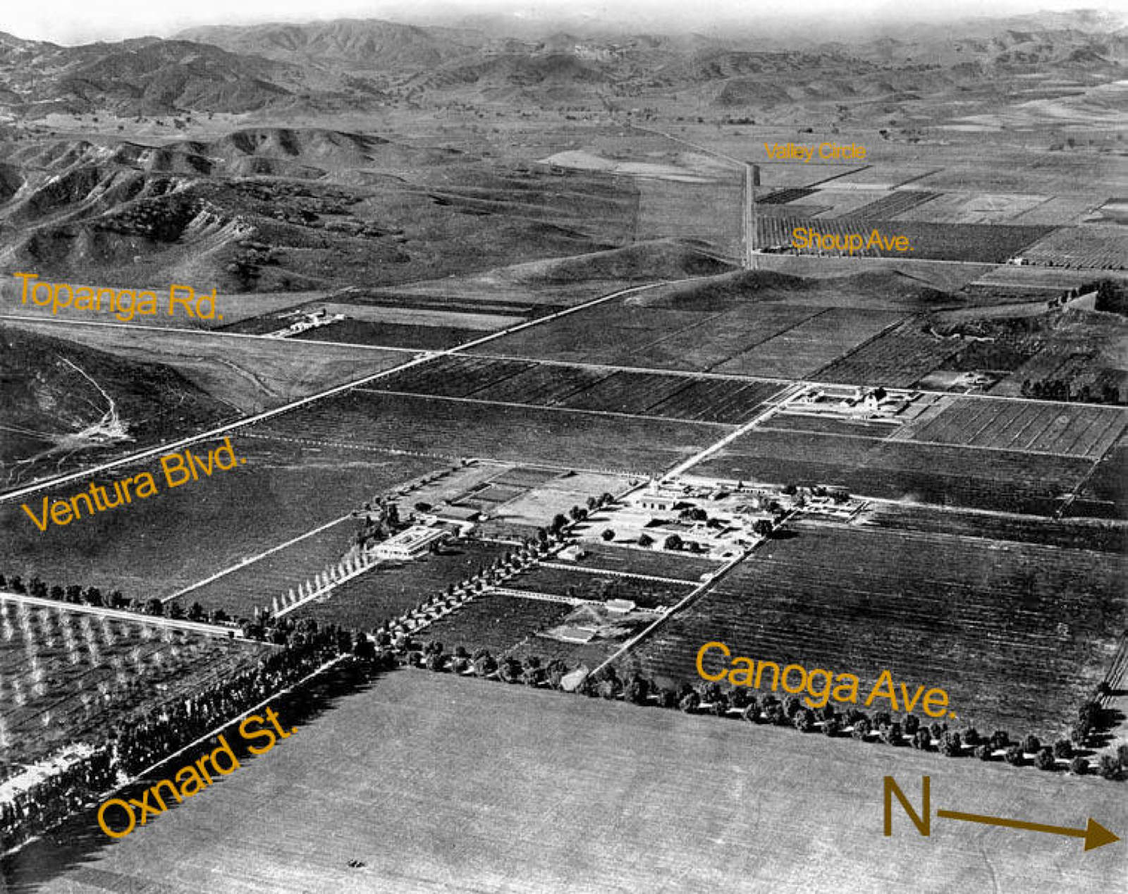
Figure 6.2. Looking southwest at Brant Ranch on Oxnard, with street names (Water and Power Associates, Inc., n.d.).
circa 1923
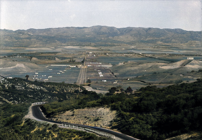
Figure 7. Looking north near Topanga summit at western part of Girard circa 1923 before Girard’s planting of thousands of trees. Note the hilltop "Girard" billboard, upper right (Water and Power Associates, Inc., n.d.).
2024
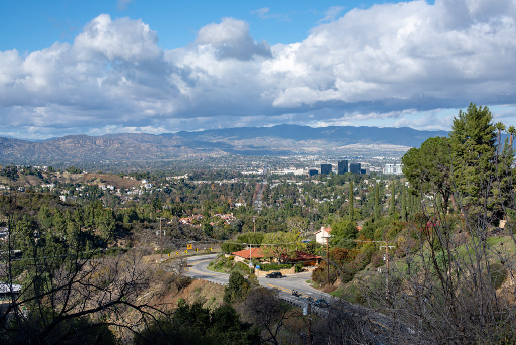
Figure 7.5 Looking north near Topanga summit at western part of "Girard" (Leggatt, 2024).
mid-1920s
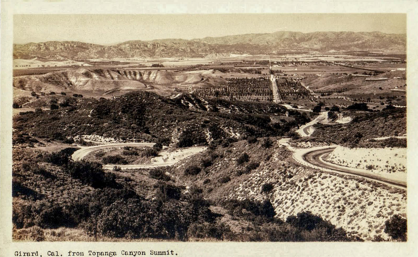
Figure 8. Looking north near Topanga summit at Girard (after Girard’s planting of trees), mid-1920s (Water and Power Associates, Inc., n.d.).
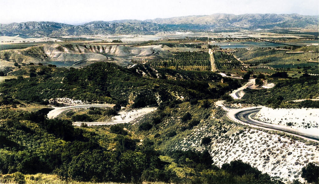
Figure 8.1. Looking north near Topanga summit at Girard (after Girard’s planting of trees), mid-1920s. Note the "Girard" billboard perched atop the hill to the far upper right at 2 o'clock. (Water and Power Associates, Inc., n.d.). [colorized]
2015
-1024.jpg)
Figure 9. Looking north near Topanga summit (Leggatt, 2015).
1915 - 1920s
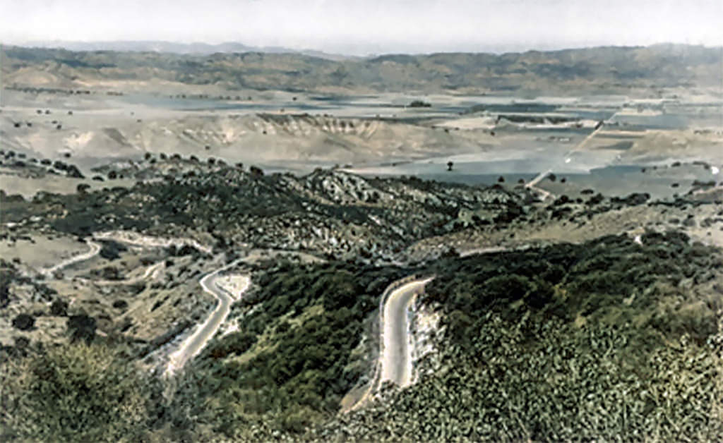
Figure 10. View of Girard from Topanga Canyon summit in 1915 (Water and Power Associates, Inc., n.d.).
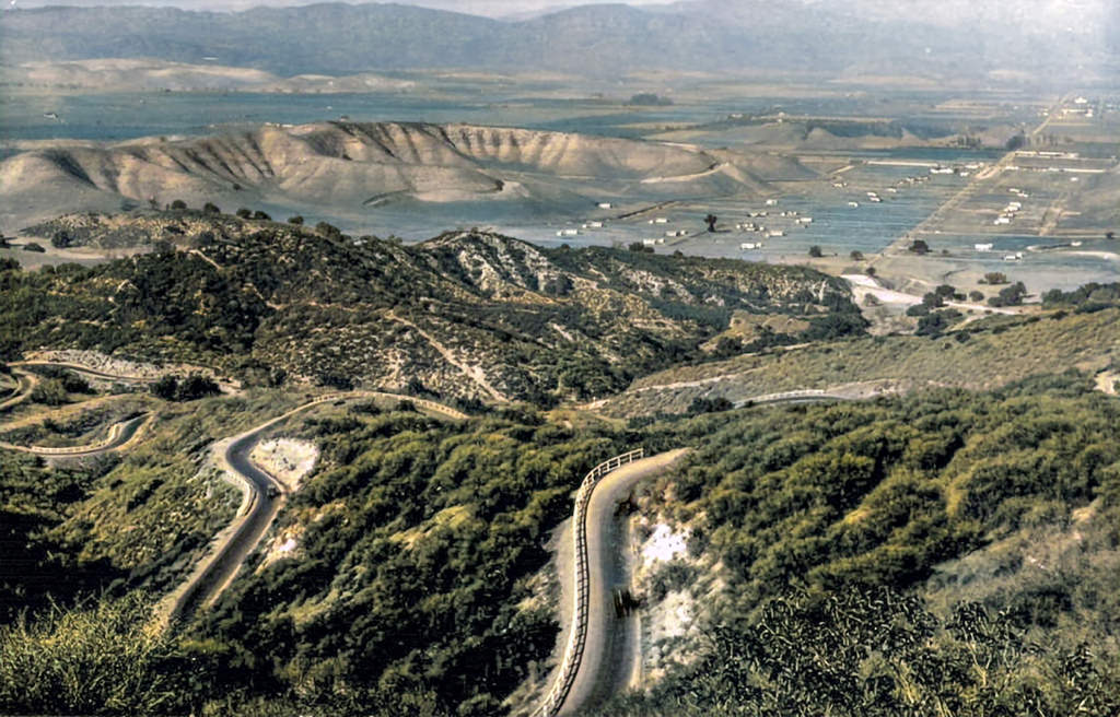
Figure 10.1 Late afternoon view of Girard from Topanga Canyon summit in 1922 (Water and Power Associates, Inc., n.d.).
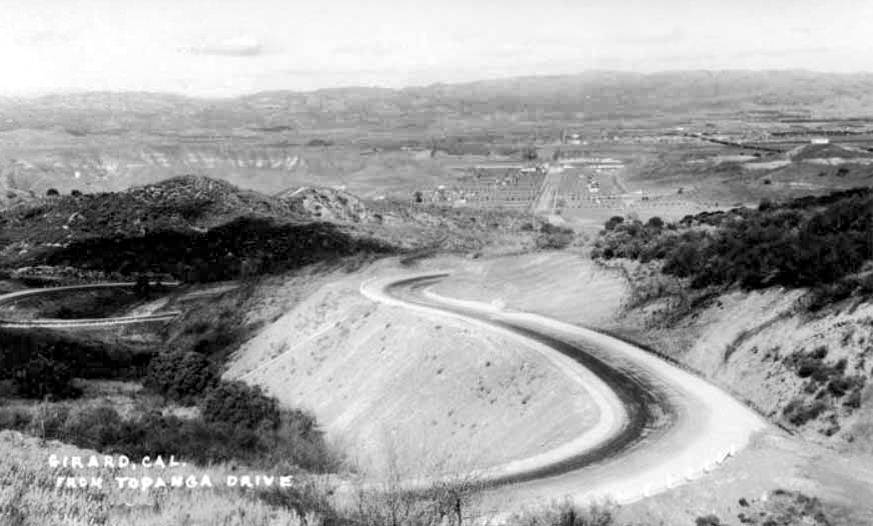
Figure 10.2 Looking north from near Topanga summit toward downtown Girard in 1920s (Water and Power Associates, Inc., n.d.).
1920s
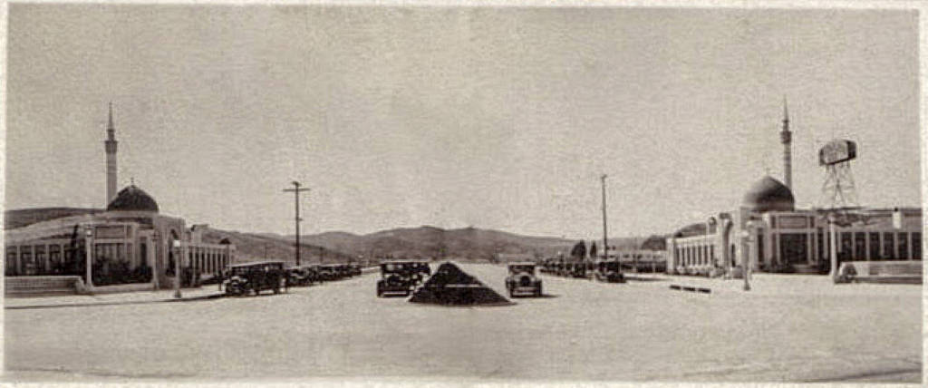
Figure 11. Looking south on Topanga Canyon Blvd. at Ventura Blvd. in 1920s (San Fernando Valley Blogspot, n.d.).
References
Architectural Resources Group, Inc. (2013). Historic Resources Survey Report. [PDF] Map data from City of Los Angeles GIS Division, 2012. https://planning.lacity.org/odocument/fc40b78c-80cf-454e-8539-7d878a094d0d/Canoga_Park_Survey_Report_3.12.13.pdf
Brenoff, A. (2008). Dig into History, You’ll Strike Snake Oil. Los Angeles Times. Retrieved from https://articles.latimes.com/2008/feb/10/realestate/re-guide10
Carmack, S. and Treffers, S. (2014). Historic Impacts Report for the Old Fire Station 84 Pocket Park Project, City and County of Los Angeles, California. [PDF]. https://www.laparks.org/environmental/pdf/oldFire/appB.pdf
Leggatt, J. (2015). Looking north near Topanga summit at western part of "Girard". [Image by the author].
Leggatt, J. (2015). Map of modern San Fernando Valley with outline of Woodland Hills. [Image rendered by author].
Leggatt, J. (2015). Photo of top of Topanga Canyon as viewed in 2015. [Image by author].
Leggatt, J. (2015). Photo of top of Topanga Canyon with northwest view of Woodland Hills as seen in 2015. [Image by the author].
Pierce College Equestrian Center (n.d.). Photo history web page. https://www.equinecenterpierce.org/then-and-now-gallery/ke6jkn58j7kubpr5anbbwfvqvm13f5
San Fernando Valley Blogspot. (n.d.). Postcard of early Topanga Canyon summit views in Woodland Hills. https://sanfernandovalleyblog.blogspot.com/2013/06/woodland-hills-postcards.html
San Fernando Valley Blogspot. (n.d.). Part of Girard promotional postcard depicting recreational activities in Girard and nearby. https://sanfernandovalleyblog.blogspot.com/2013/06/woodland-hills-postcards.html
University of Southern California. Libraries. (n.d.). Birdseye view of San Fernando Valley from near Topanga Canyon Road. Photograph of a birds-eye view of San Fernando Valley from near Topanga Canyon Road, ca.1914. https://calisphere.org/item/963ee1ebfbbcdcf1b328bfe1b5dba6ef/
Water and Power Associates, Inc. (n.d.) Early map of the San Fernando Valley showing locations of towns and ranches. https://waterandpower.org/museum/Early_Views_of_the_San_Fernando_Valley_1_of_10.html
Water and Power Associates, Inc. (n.d.) Detailed map of the San Fernando Valley as it appeared in the mid-1920s. https://waterandpower.org/museum/Early_Views_of_the_San_Fernando_Valley_Page_2.html
Water and Power Associates, Inc. (n.d.). View of Girard neighborhoods adjacent to Topanga Canyon Blvd. before trees were planted. https://waterandpower.org/museum/Early_Views_of_the_San_Fernando_Valley_Page_2.html
Water and Power Associates, Inc. (n.d.). View of Girard neighborhoods adjacent to Topanga Canyon Blvd. after trees were planted. https://waterandpower.org/museum/Early_Views_of_the_San_Fernando_Valley_Page_2.html